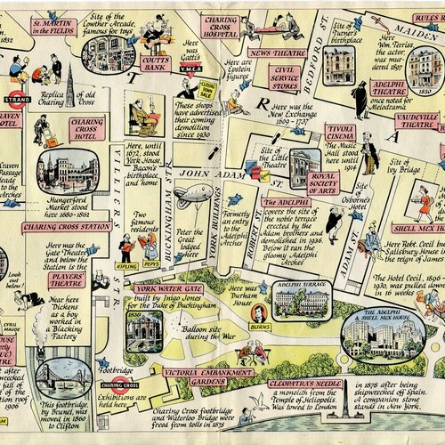

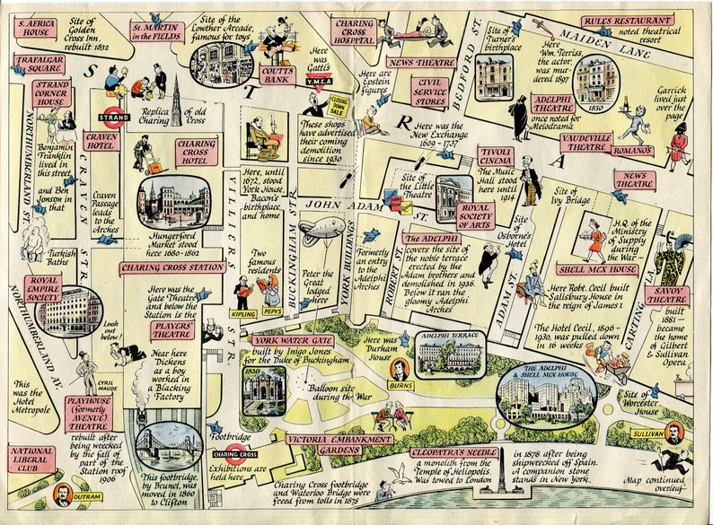
Product code: 1947 A Map of the Strand, Trafalgar Square to Aldwych, London. A Pictorial Map by J. P. outlet Sayer
outlet 1947 A Map of the Strand, Trafalgar Square to Aldwych, London. A Pictorial Map by J. P. Sayer
This is a folding map I have shown scans of both sides. There is a center fold as issued.
TITLE: A Map of the Strand, Trafalgar Square to Aldwych...
DATE PRINTED: 1947
SIZE: The map page is approx. 10.5 x 7.8 inches. There is text and the title page on the reverse side
CONDITION: I would describe as fair condition for its age. Small staple holes along the center fold as always. Please study the 2 detailed scans for condition and all details before purchasing. Thank you.
Shipping: This is a folding map (one fold down the center) and will be shipped folded in a protective rigid envelope with an insert.